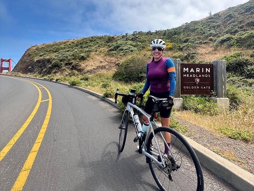
Marin Headlands
Sausalito, California
Road
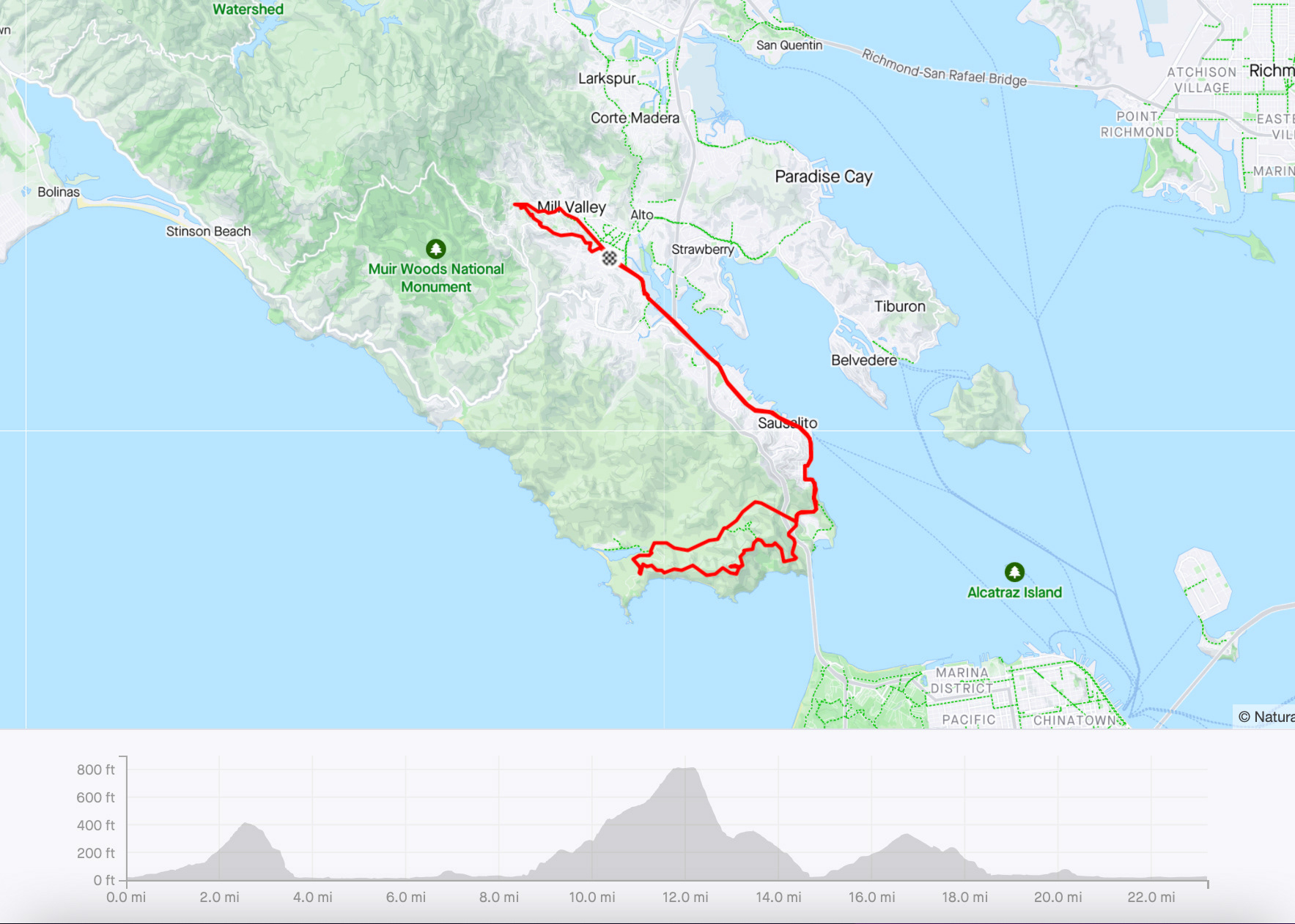
23 miles | 1,900 ft elevation
Ride date: June 2023
A ride through the Marin Headlands is a quintessential Bay Area route that makes for a great day on the bike - city and coastal views, steep climbs and fast descents. I like to start from Mill Valley, so that I can begin the route with some warm-up miles.

Park along Miller Ave (some spots have a 2-hour limit, but there are spots with no time limit) and head north. The first 4 miles take you through Mill Valley and up into a residential neighborhood nestled below the redwood trees. After the warm-up loop, you will leave Mill Valley and hop on the Mill Valley-Sausalito bike path for the next 1.5 miles. Just after Mikes Bikes, the path ends and you cross the street to continue along Bridgeway in the bike lane. The next couple miles can be busy as you head toward Sausalito, so stay alert for tourists (both in cars and on foot).
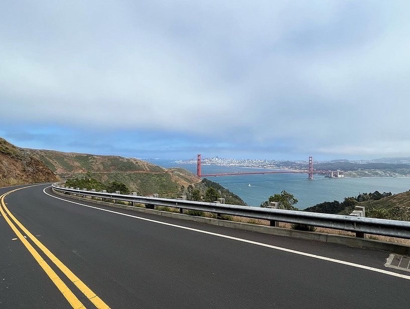
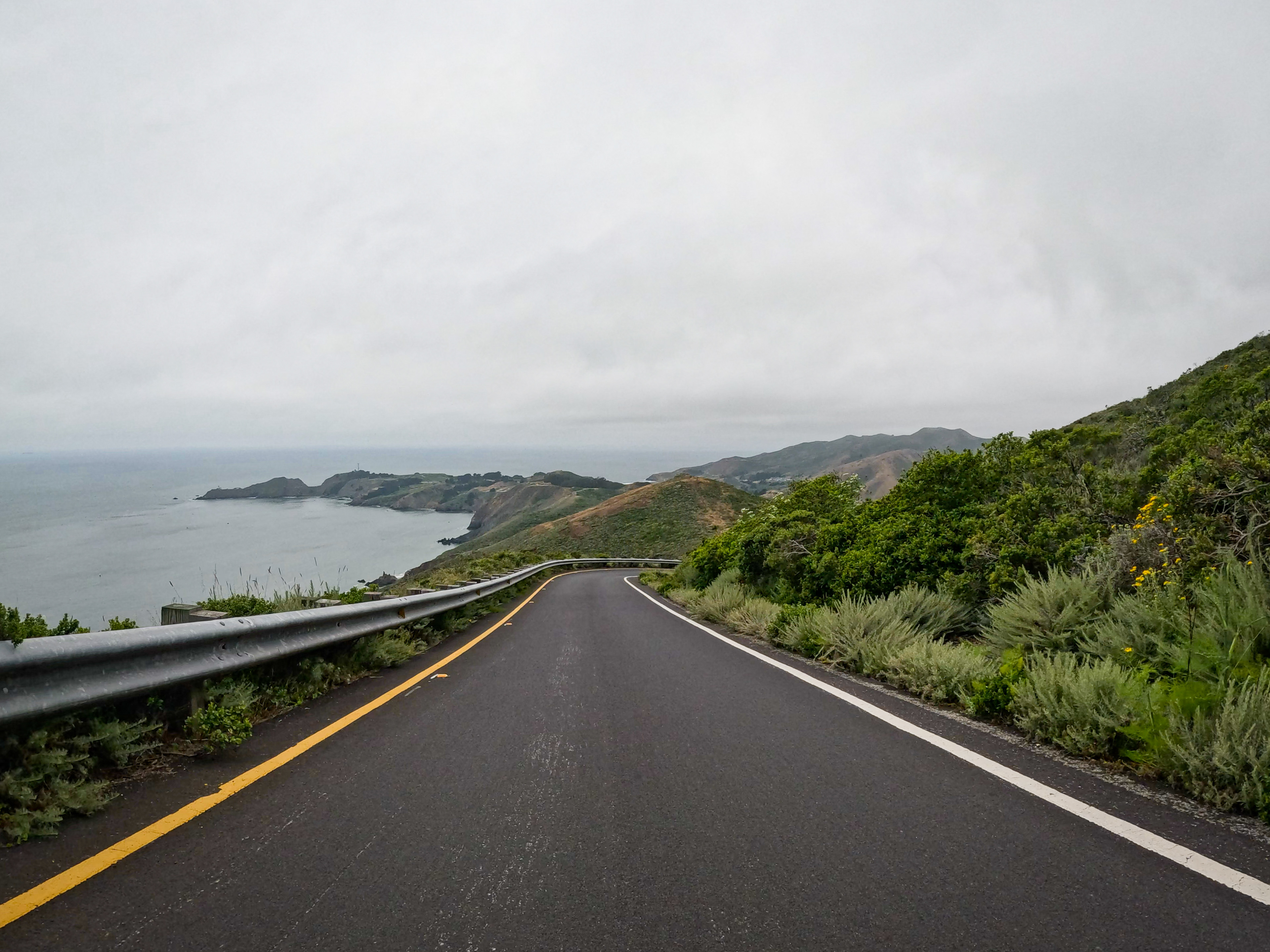
Around mile 8, you will see the city in the distance as you pass by the harbor, and you will begin the ascent leaving Sausalito and heading towards San Francisco. At mile 10, after you pass under the freeway, stay to the right and begin the climb up Conzelman Road into the Marin Headlands. The 2-mile climb has several areas where you can pull over and enjoy the spectacular views of San Francisco and the Golden Gate Bridge (if it’s not too foggy!)
Once you reach the top (Hawk Hill), you can explore the tunnels and old missile control site. Then when you’re ready, continue on Conzelman Road down the backside of Hawk Hill to do the Headlands loop.
(Note: be aware that the descent is very, very steep, so you should have good brakes and downhill handling skills. I personally find this descent to be scary on my bike with rim brakes. I prefer doing this descent with disc brakes. If you’re feeling nervous or unsure, turn around and go back the way you came up and then head back towards Sausalito.)
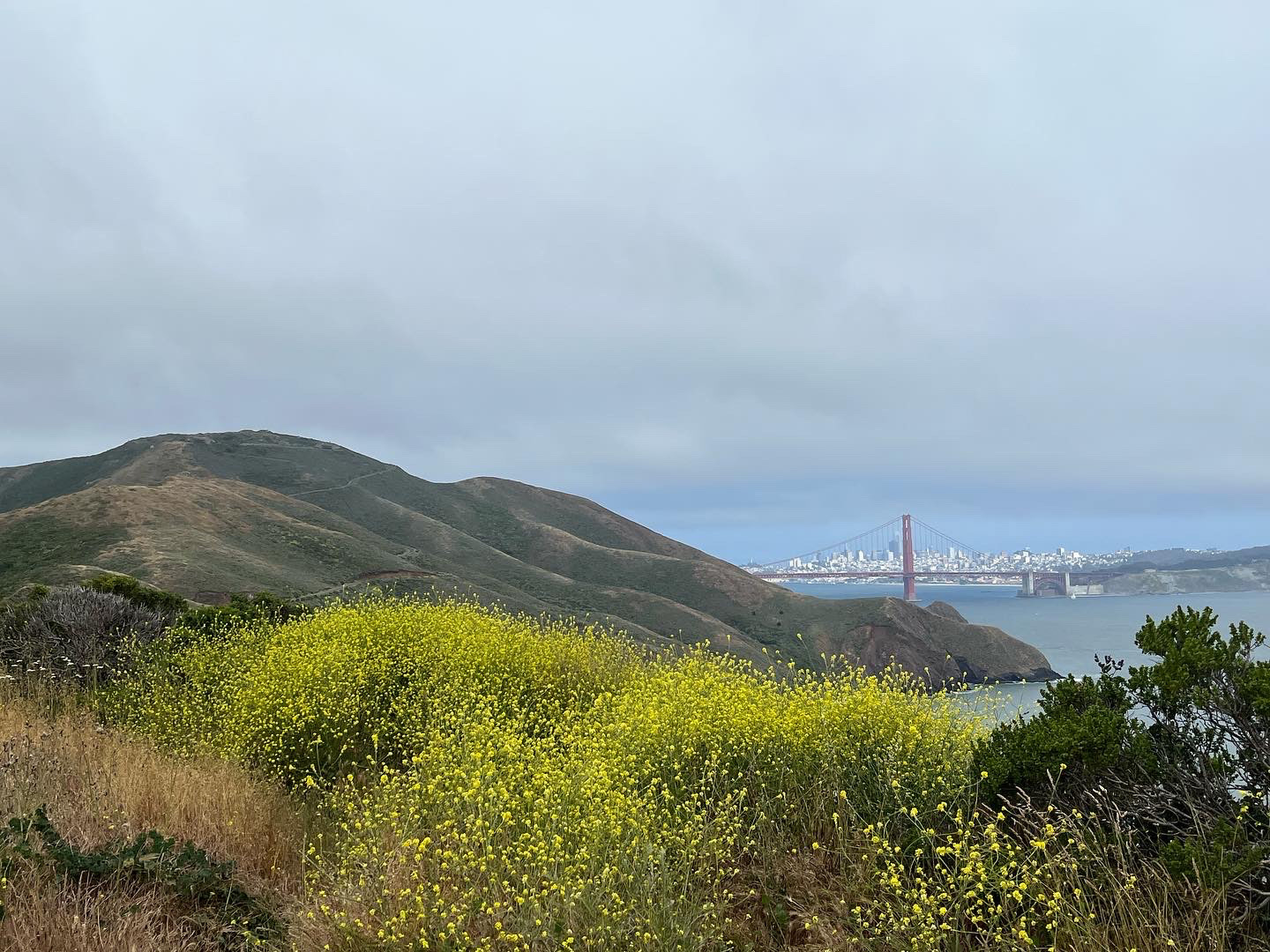
The 2-mile descent is truly breathtaking as you soar down along the water. Once it flattens out, you’ll pass by more bunkers and historical sites. Around mile 14, you’ll take a right onto Field Road and then Bunker Road to start making your way out of park.
(If you’re feeling adventurous you can explore the Headlands and when you’re ready to head back, jump on Bunker Road and head east.)
For the next few miles, enjoy the scenic rolling hills until you reach the Baker-Barry Tunnel. This tunnel is one-way for cars and has a bike lane in both directions for cyclists. Be aware that depending on the timing of the traffic light (holding cars until it’s their turn), you may experience cars driving towards you as you ride through the tunnel (which can feel a little uneasy on busy days).
After exiting the tunnel, take a left onto Alexander Ave and the last 6-miles will take you back the way you came through Sausalito and along the bike path to Mill Valley.
Notes
This route can be easily modified to make it longer or shorter. You can make it longer by crossing the Golden Gate Bridge into San Francisco or by adding on the Tiburon Paradise Loop. You can make it shorter by cutting out the Mill Valley redwoods loop or cutting out the Marin Headlands loop (turn around at the top of Hawk Hill).
The Baker-Barry Tunnel is well lit, but lights are recommended to increase drivers’ visibility of you.
Alternative Mill Valley parking/starting location: City of Mill Valley Recreation Department (180 Camino Alto, Mill Valley, CA 94941) Park under the solar panels near the bike path.
cyclingjenny.com aims to provide content that is true and accurate as of the date of writing; however, the accuracy and judgment of the author is not guaranteed. cyclingjenny.com and its associates are in no way liable for personal injury, loss or damage to personal property, or any other such situation that should occur to individuals following the guides, routes and recommendations. Please review the full Terms & Disclaimer.