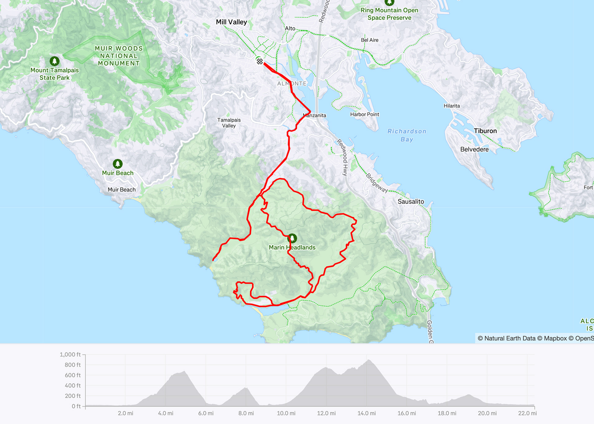
Tennessee Valley - Marin Headlands
Mill Valley, California
Gravel
21 miles | 2,300 ft elevation | 52% gravel
Ride date: June 2025
Marin County is one of my favorite places to ride gravel, especially within the Golden Gate National Recreation Area. There are a number of different trails and being surrounded by hills makes for some challenging miles, but the views are stunning and idyllic. This route takes you on dirt trails (and a little bit of pavement) through the Tennessee Valley and Marin Headlands.
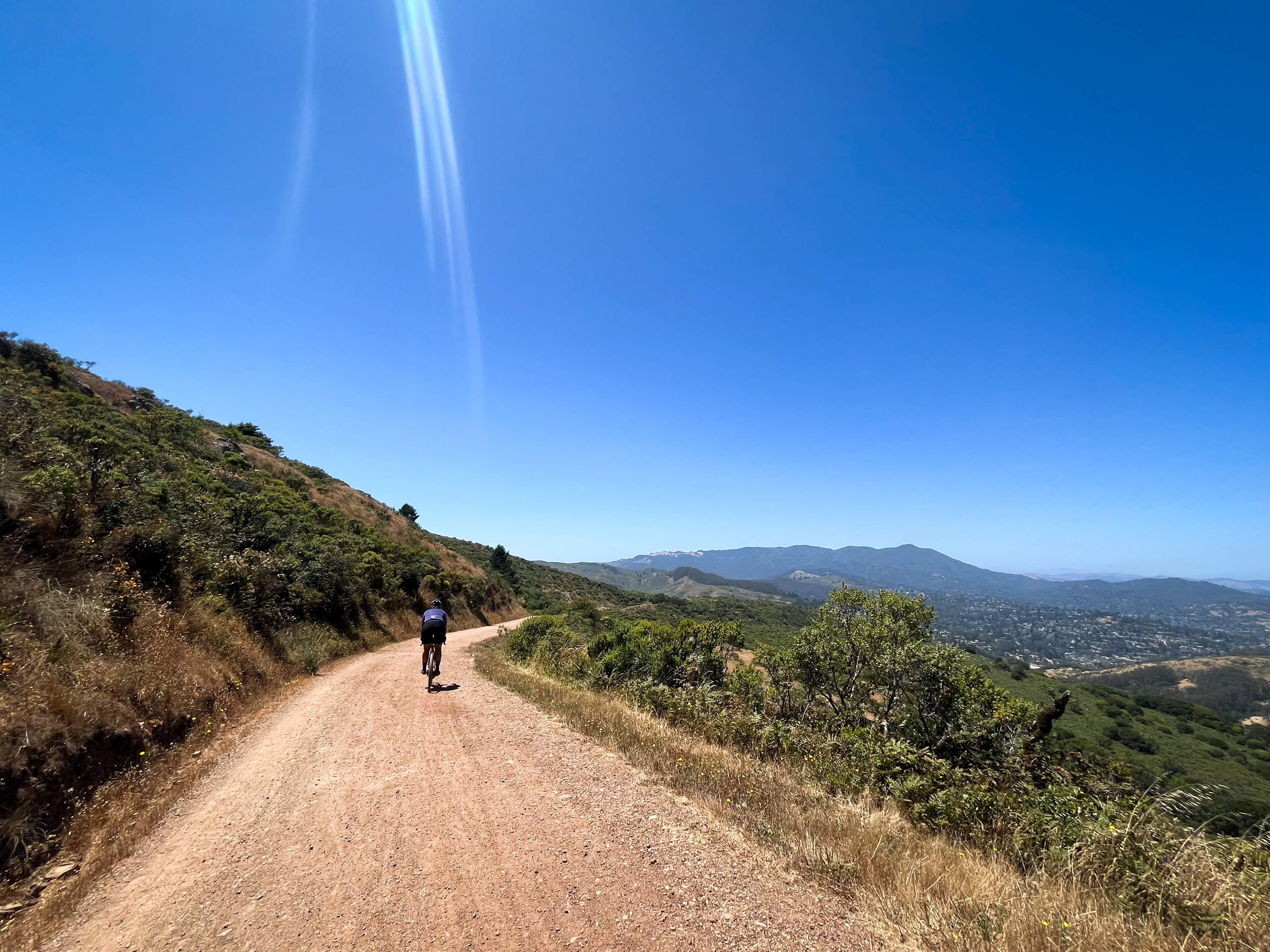
Starting in Mill Valley, take Miller Avenue south and hop on the Mill Valley-Sausalito Path. About a mile into the ride, make a right onto the Charles F. McGlashan Pathway for another mile of car-free riding until you reach Tennessee Valley Road.
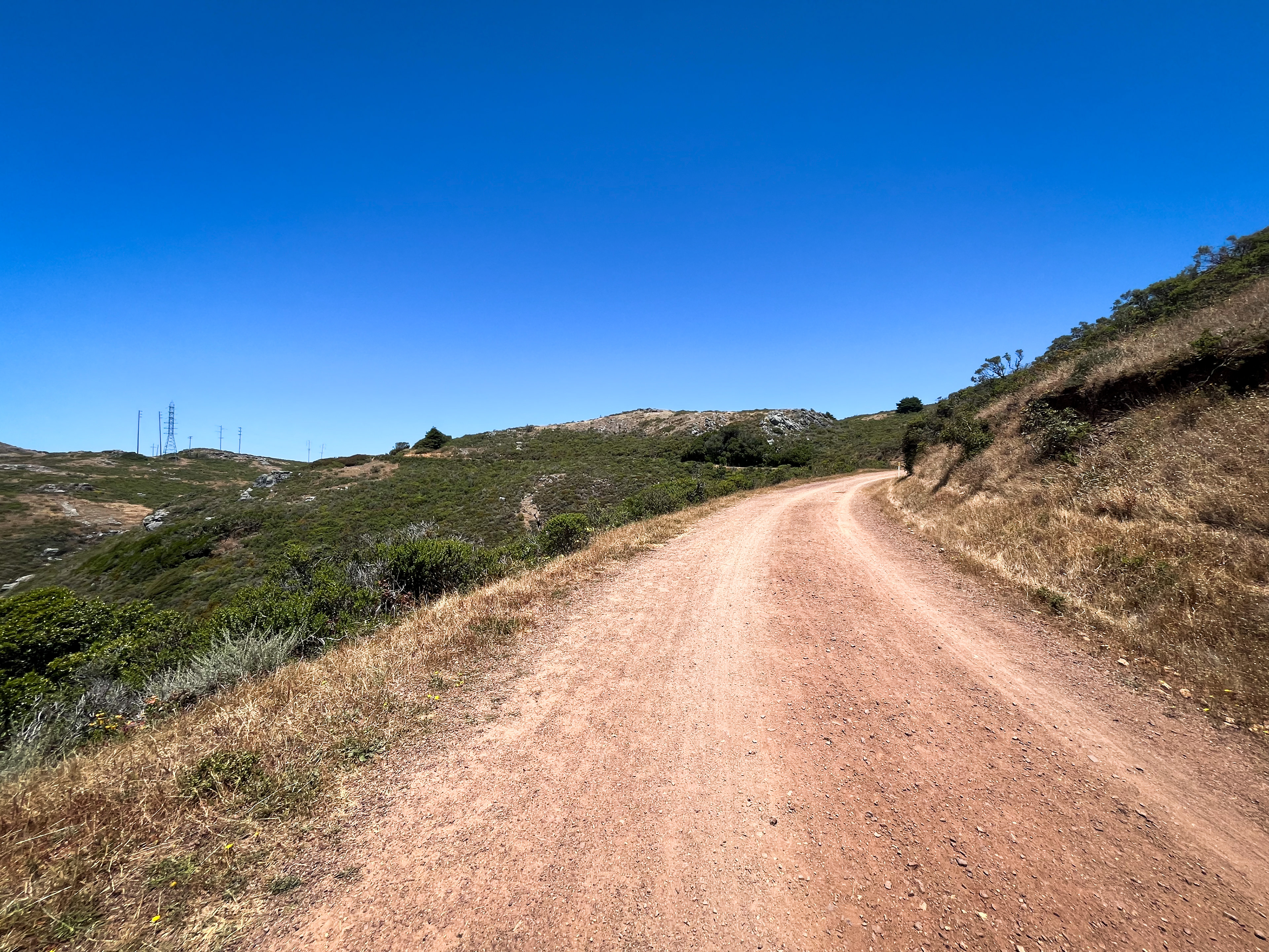
You’ll climb for about a mile until you reach the Tennessee Valley Trailhead parking lot. Stay left and head toward the horse stables and make your way to the start of Old Springs Trail (be sure to follow the signage and walk your bike as you pass the stables).
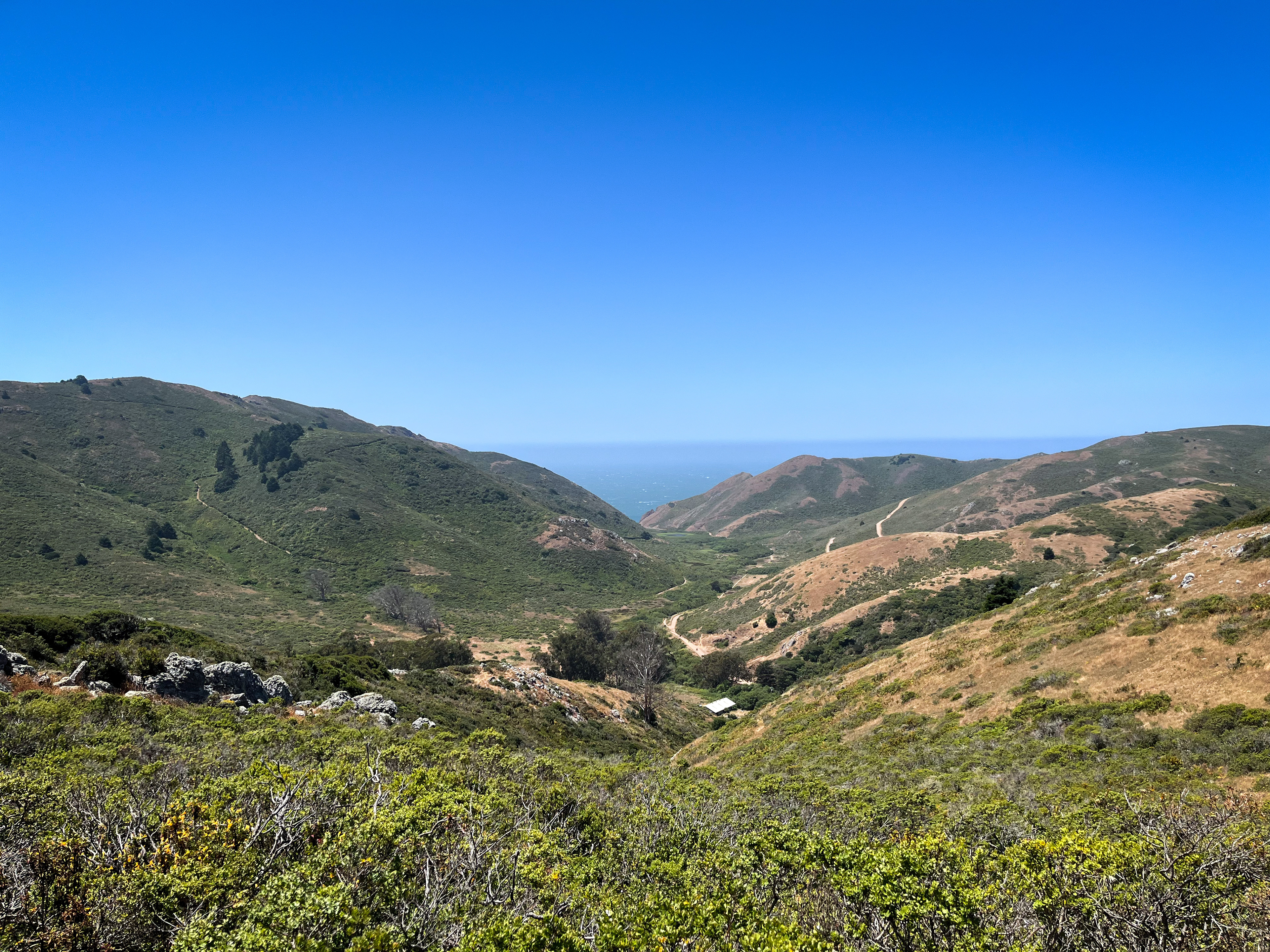
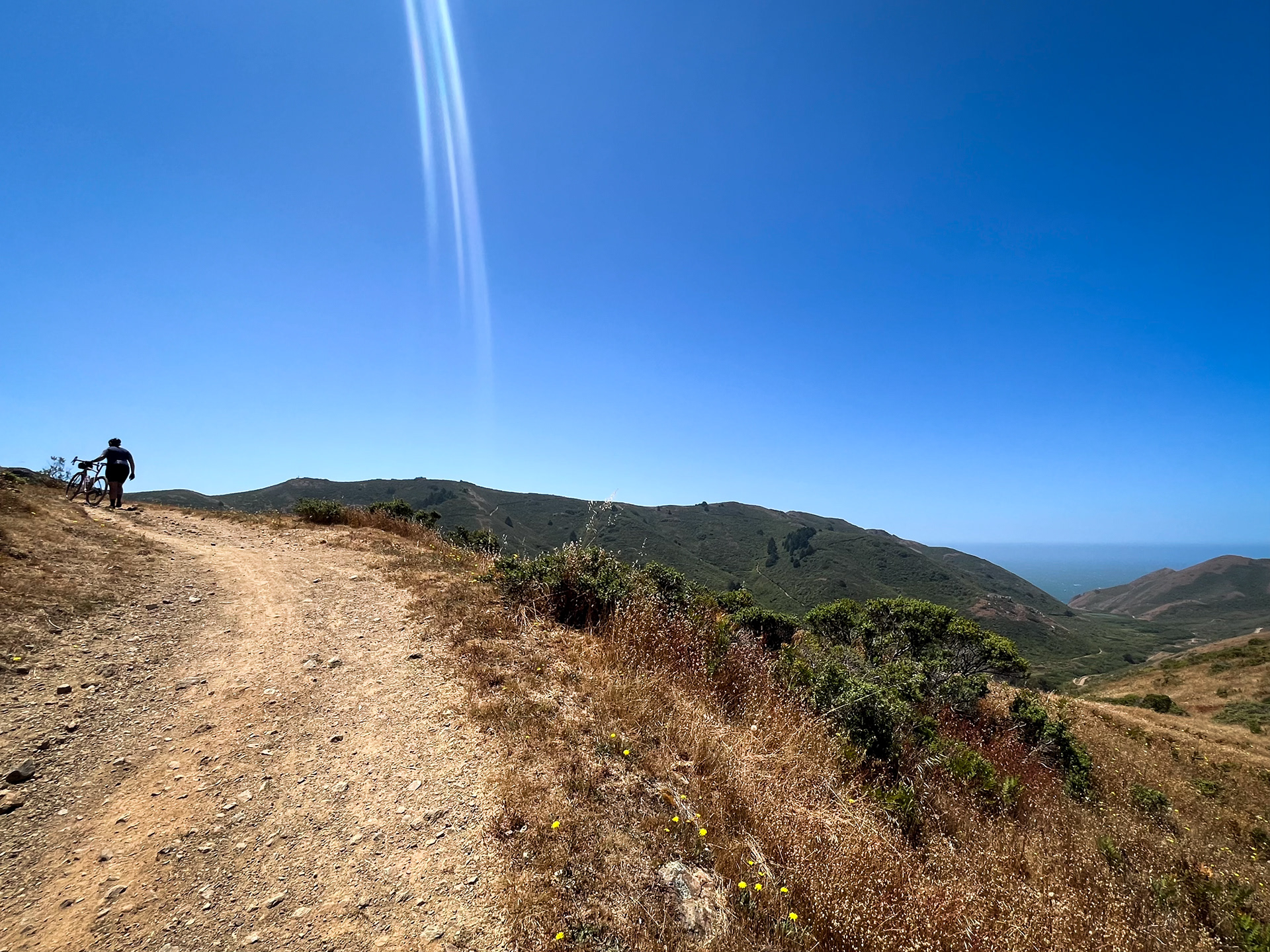
The first mile on Old Springs is steep (including some trail stairs), so hike-a-bike will be necessary for most, but before you know it, you’ll be rewarded with panoramic views of the Tennessee Valley as you near the top. You know the hard part is over once you reach the wooden slats on the trail and soon you’ll merge onto the Miwok Trail. Around mile 5, you’ll make the descent down Miwok into the Marin Headlands (watch your speed as you can get going quick in spots!)
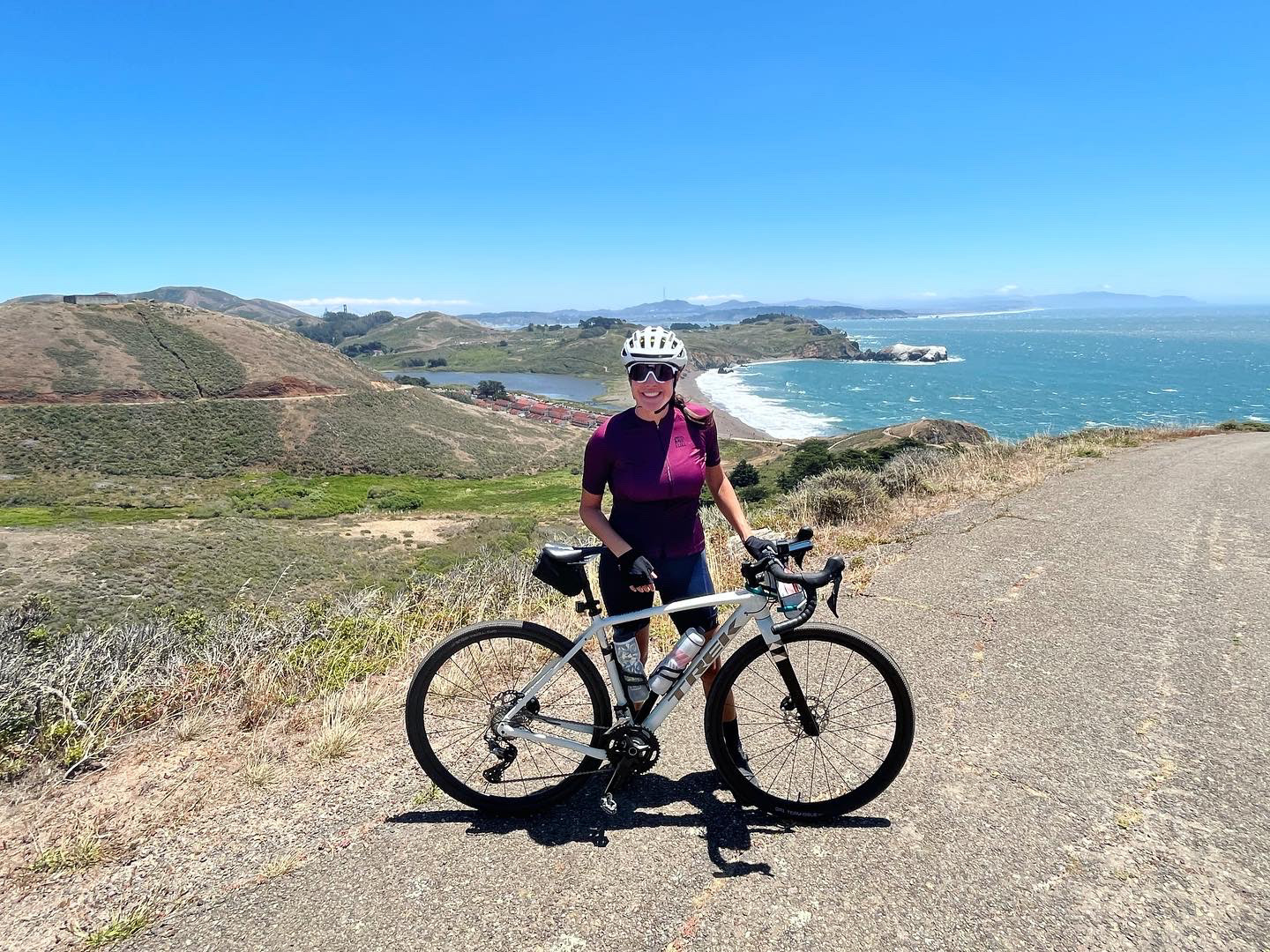
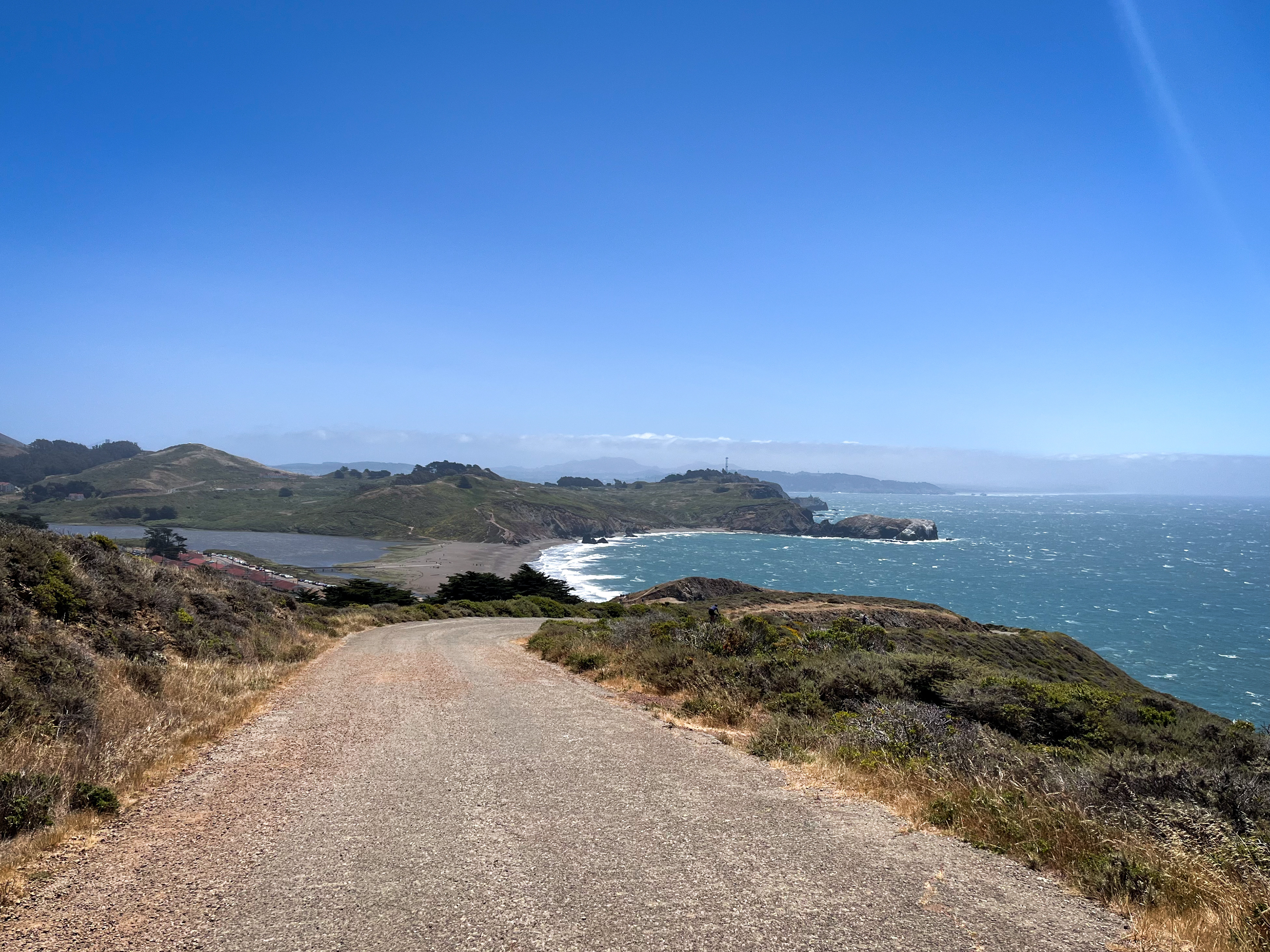
Exit the trailhead and jump onto Bunker Road, where you’ll briefly share the road with cars. As you start climbing, you’ll pass through a gate and the rest of this paved 1-mile climb is car-free. You’ll hug the curves of the hills to your right and to the left are views of the ocean and Rodeo Beach. Around mile 8, you’ll pass Battery Townsley, a World War II military fortification and great spot for a photo op.
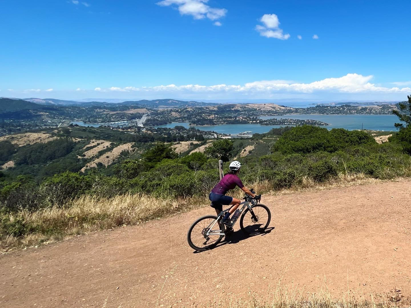
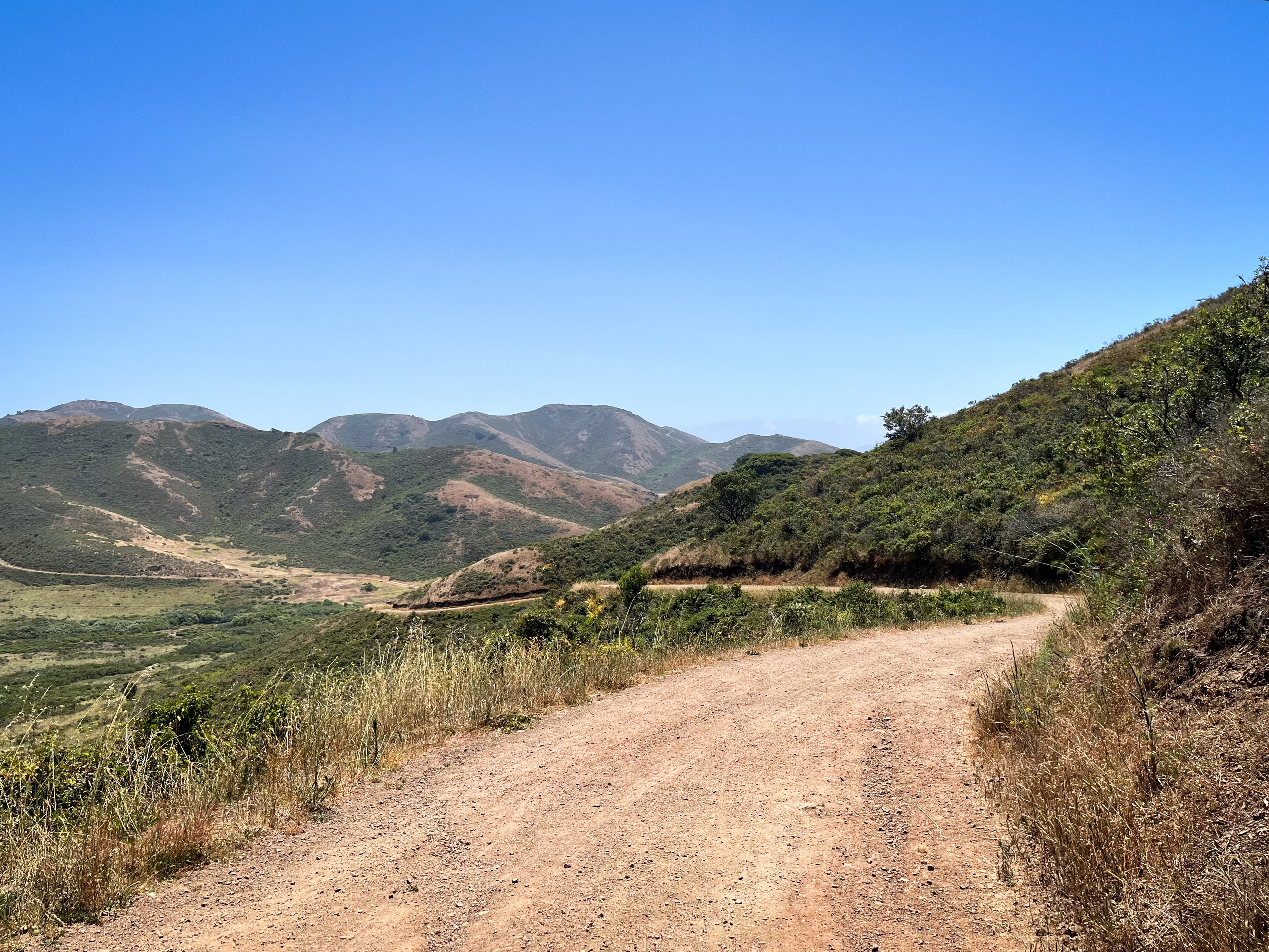
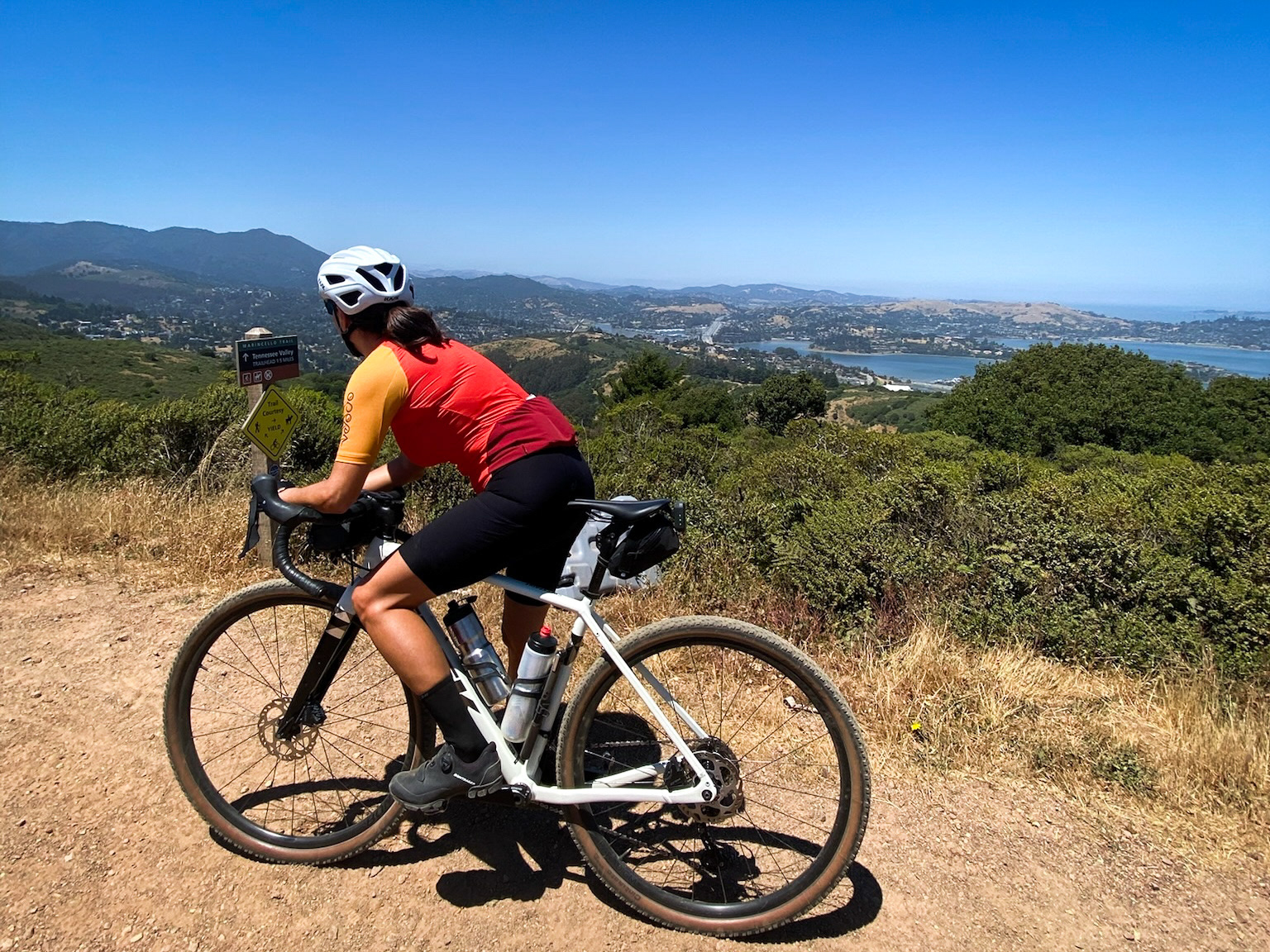
From there it’s a fun descent, feeling as though you’ll ride right into the ocean as you swoop down to Rodeo Beach. Make your way through Fort Cronkhite and back to the Miwok Trailhead (where you exited earlier). After about half a mile on Miwok, veer to the right and continue along Bobcat Trail (around mile 10). You will climb up Bobcat for about 2 miles until you reach what seems like the top, but stay to the left to continue down a brief downhill section before the final half mile up Bobcat to the top. Enjoy the amazing view of Marin and the Richardson Bay before taking the Marincello Trail for about 1.5 miles down to the Tennessee Valley Trailhead parking lot.
Ride the Tennessee Valley Trail down to the beach and back for some extra miles. (It can get busy at times with others enjoying the trail via bike and foot, so if it is crowded, you can skip this section). From the parking lot, you’ll head back to Mill Valley the same way you started the ride, down Tennessee Valley Road and along the bike paths back into town.
Strava Route:
Notes
There is parking along Miller Avenue as you drive through Mill Valley. Pay attention to signage as some spots have time limits and others do not.
An alternative starting point is to park at the Tennessee Valley Trailhead. This parking lot is popular and it may be hard to find a spot during peak times.
Be prepared for changes in climate on this ride, as it can be hot in Tennessee Valley and then cold, foggy and windy near Rodeo Beach.
cyclingjenny.com aims to provide content that is true and accurate as of the date of writing; however, the accuracy and judgment of the author is not guaranteed. cyclingjenny.com and its associates are in no way liable for personal injury, loss or damage to personal property, or any other such situation that should occur to individuals following the guides, routes and recommendations. Please review the full Terms & Disclaimer.